 Click to enlarge
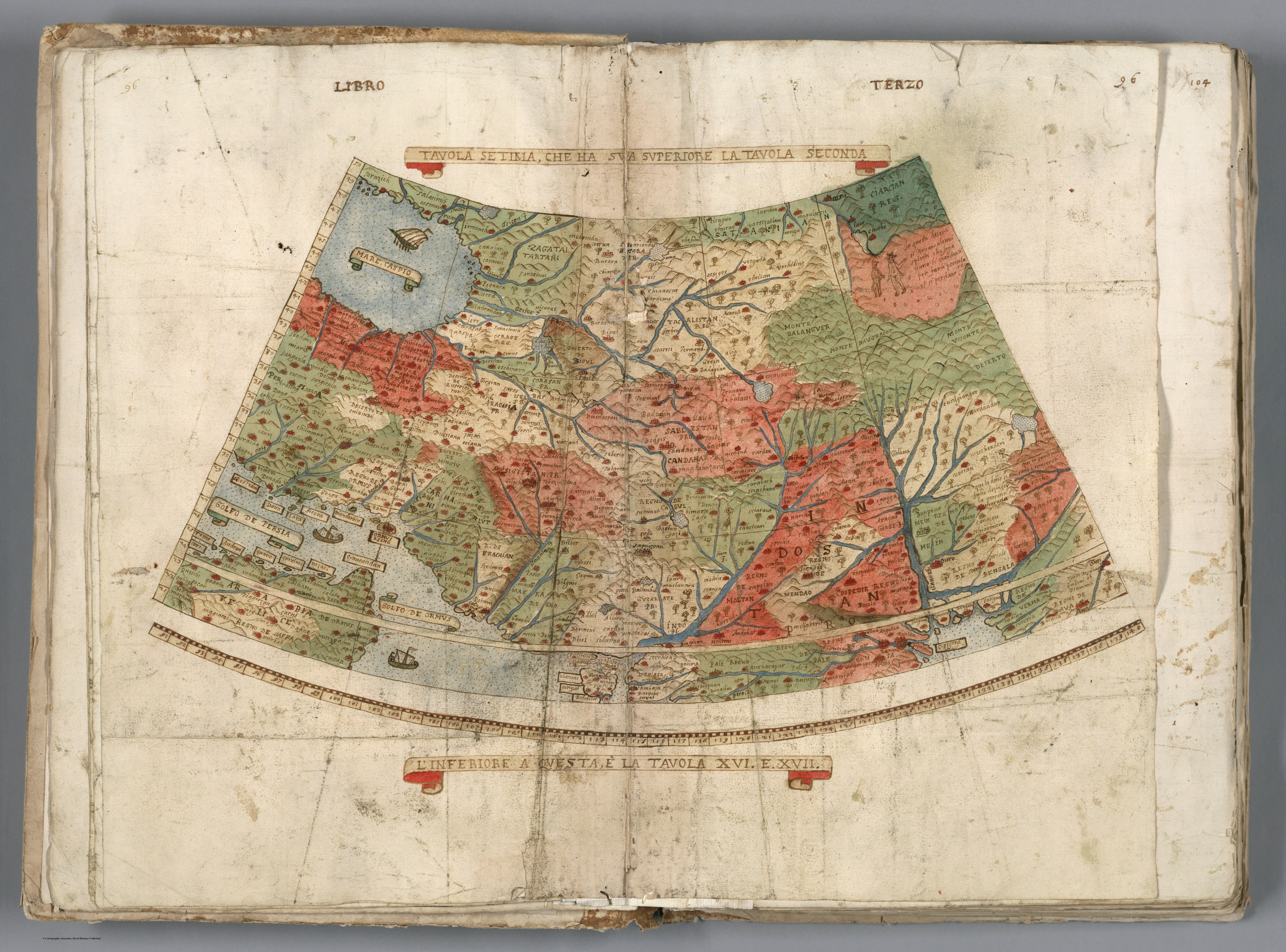
Tavola Setima, Che Ha Sua Superiore La Tavola Seconda. Libro Terzo
A single leaf from Urbano Monte's manuscript world map of 1587 — a sixty-sheet planisphere drawn on a north-polar projection that, assembled, forms the largest world map of the sixteenth century at roughly nine feet square. This seventh table falls in the Asian quadrant, showing the subcontinent and Indian Ocean as one wedge of Monte's all-encompassing circular earth.
Authorship and object
Urbano Monte (1544–1613), a Milanese scholar of independent means, compiled his tavole as a manuscript wall map; the example here is one of only three surviving versions of the project (two manuscript, one later printed on sixty-four plates in 1604). It was never a navigational tool but a cosmographic encyclopaedia, gathering the world's known geography into a single disc centred on the North Pole.
A radical projection
The defining feature is the polar azimuthal projection. Rather than the rectangular Ptolemaic or Mercator frame, Monte projected the whole earth outward from the pole, so that on any one sheet the meridians fan and familiar outlines skew — India arrives rotated and stretched, its shape subordinated to the geometry of the whole. It is one of the earliest sustained attempts at a polar projection of the entire world.
Content
Monte's sources are the printed maps of his day — Gastaldi, Ortelius and the Portuguese tradition — recompiled by hand and crowded with kingdoms, rulers, beasts and ethnographic notes in the encyclopaedic manner of the late Renaissance.
The gaze
Here India is not observed but catalogued — one tessera in a totalising scheme that aspires to hold the entire globe in a single view. The ambition is comprehension rather than accuracy: the world, and India within it, as something to be assembled, ordered and possessed on paper.