← Baroque Mughals and Companies
 Click to enlarge
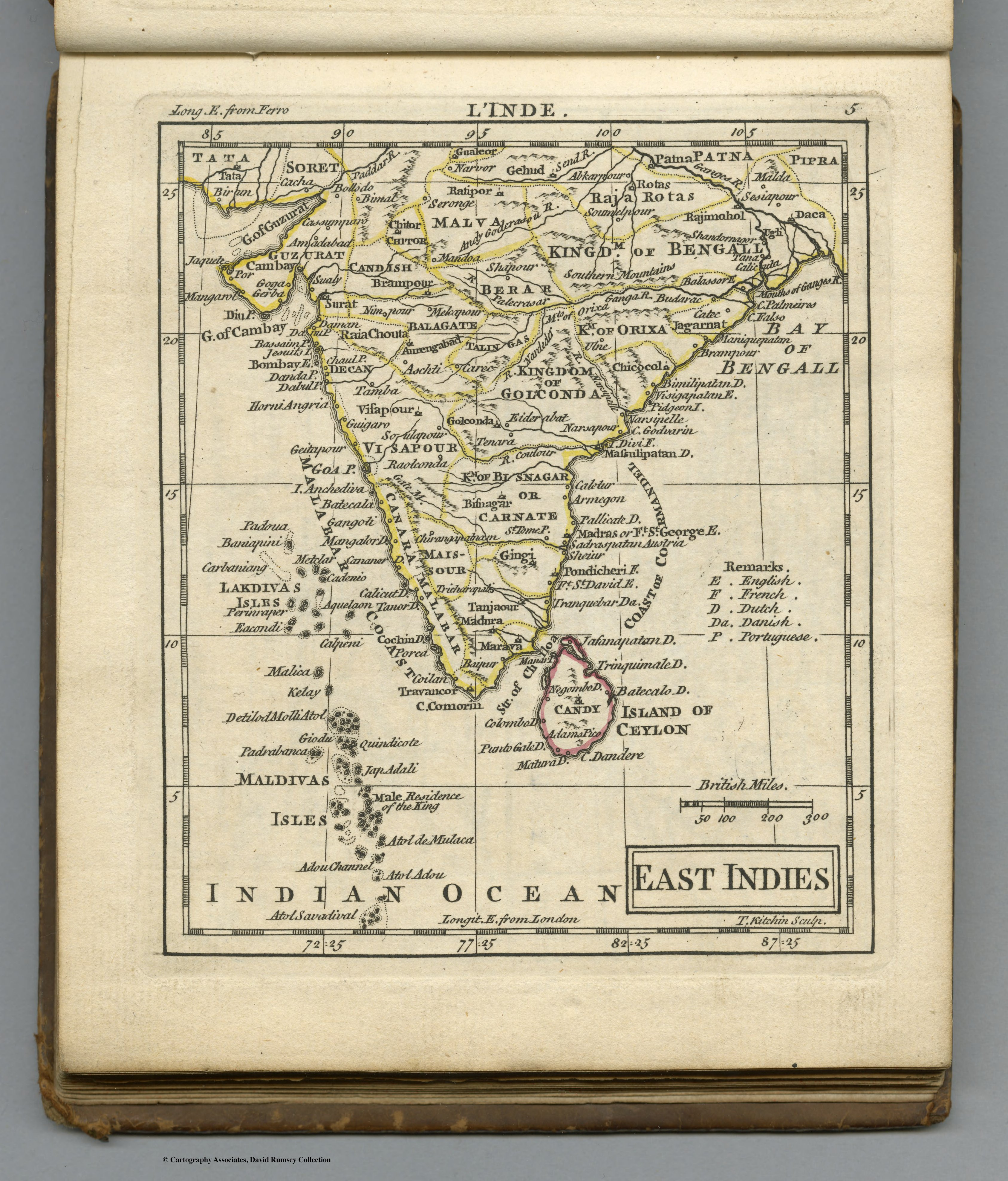
East Indies
A small pocket-atlas map of the East Indies by Andrew Dury of London, published in the very year the Treaty of Paris confirmed British ascendancy in India. A modest commercial map that catches a pivotal moment — from the British side.
Authorship and object
From Andrew Dury's New General and Universal Atlas (London, 1763), a small pocket atlas with most plates engraved by Thomas Kitchin and others. The maps carry French titles above or below the neatline as well as English, which suggests Dury worked from a French model.
A map of its moment
Issued the year the Seven Years' War ended, the atlas registers the new settlement — the 1763 Treaty of Paris, which left Britain the dominant European power in India and North America alike. The map is unremarkable as geography but pointed in its timing: a British commercial product appearing just as British India was beginning.
The gaze
Where the room's earlier maps view India through French and Dutch eyes, Dury's marks the drift of cartographic initiative toward London. It is a small, cheap, confident map of a world Britain had just gained the upper hand in — the commercial gaze of the power about to become the territorial one.