← Home Ground Bombay and Deccan
 Click to enlarge
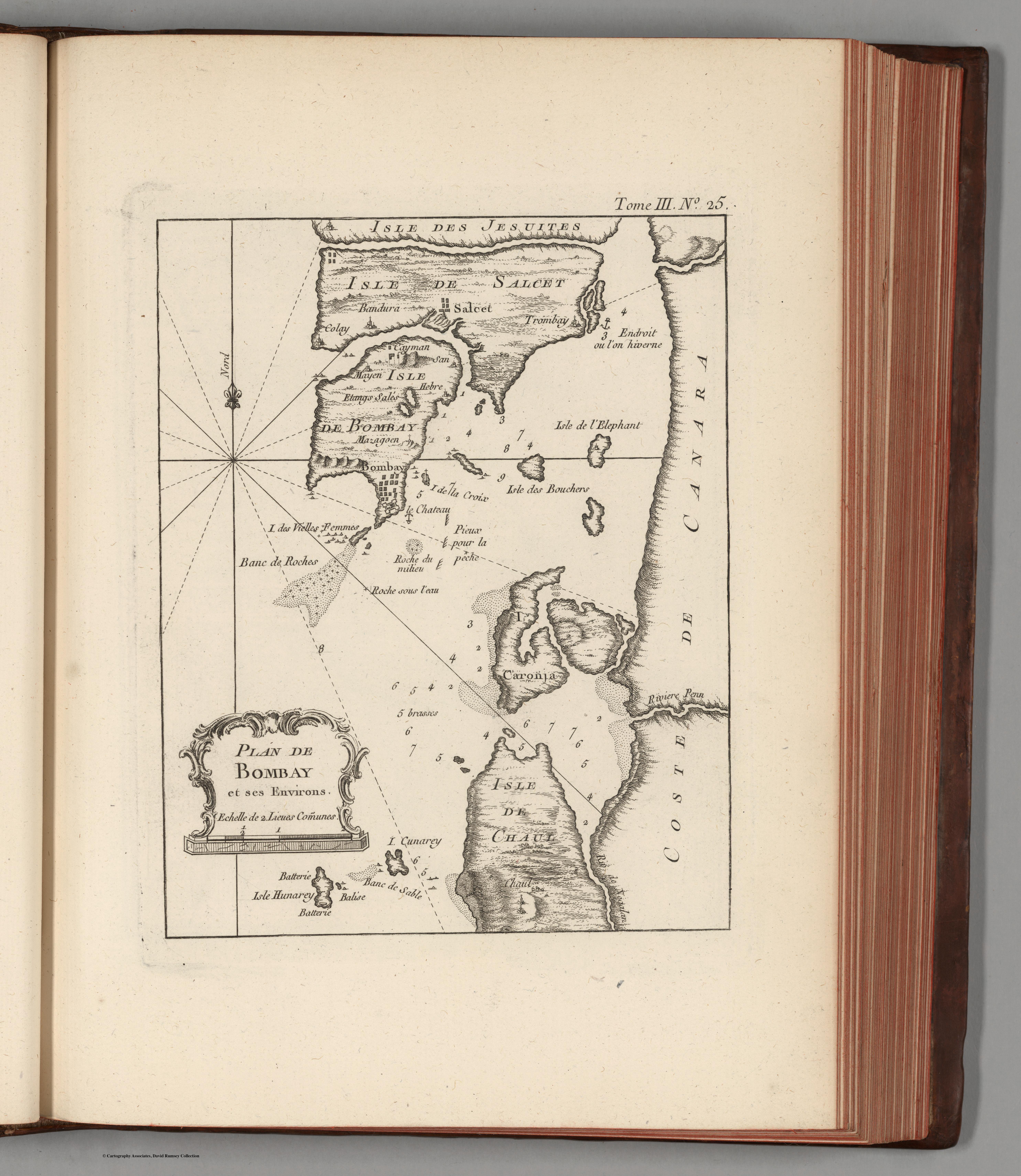
Plan de Bombay
Jacques-Nicolas Bellin's harbour plan of Bombay, from his Petit Atlas Maritime — a French naval chart of the island and its anchorage. The first sign in this room of the gaze tightening from the whole subcontinent to a single, strategically valued harbour.
Authorship and object
Bellin (1703–1772), chief hydrographer of the French Dépôt de la Marine, produced this plan for his Petit Atlas Maritime (Paris, 1764), a five-volume compilation of some 580 charts of the world's coasts and ports — the best such collection of its time. A chart rather than a land map: depths shown by soundings, with a decorative title cartouche.
A harbour, not a country
The subject is the road and island of Bombay as a place to bring ships safely to anchor — the scale of the pilot and the naval officer, not the geographer. France held no part of Bombay; the interest is in knowing a rival's harbour.
The gaze
That a French naval atlas should chart Bombay in detail says much. The subcontinent is beginning to be seen not only whole and from above, but harbour by harbour and from the water — each port weighed for the ships and the trade it could hold. The home ground of this collection opens, fittingly, at the anchorage.