← Home Ground Bombay and Deccan
 Click to enlarge
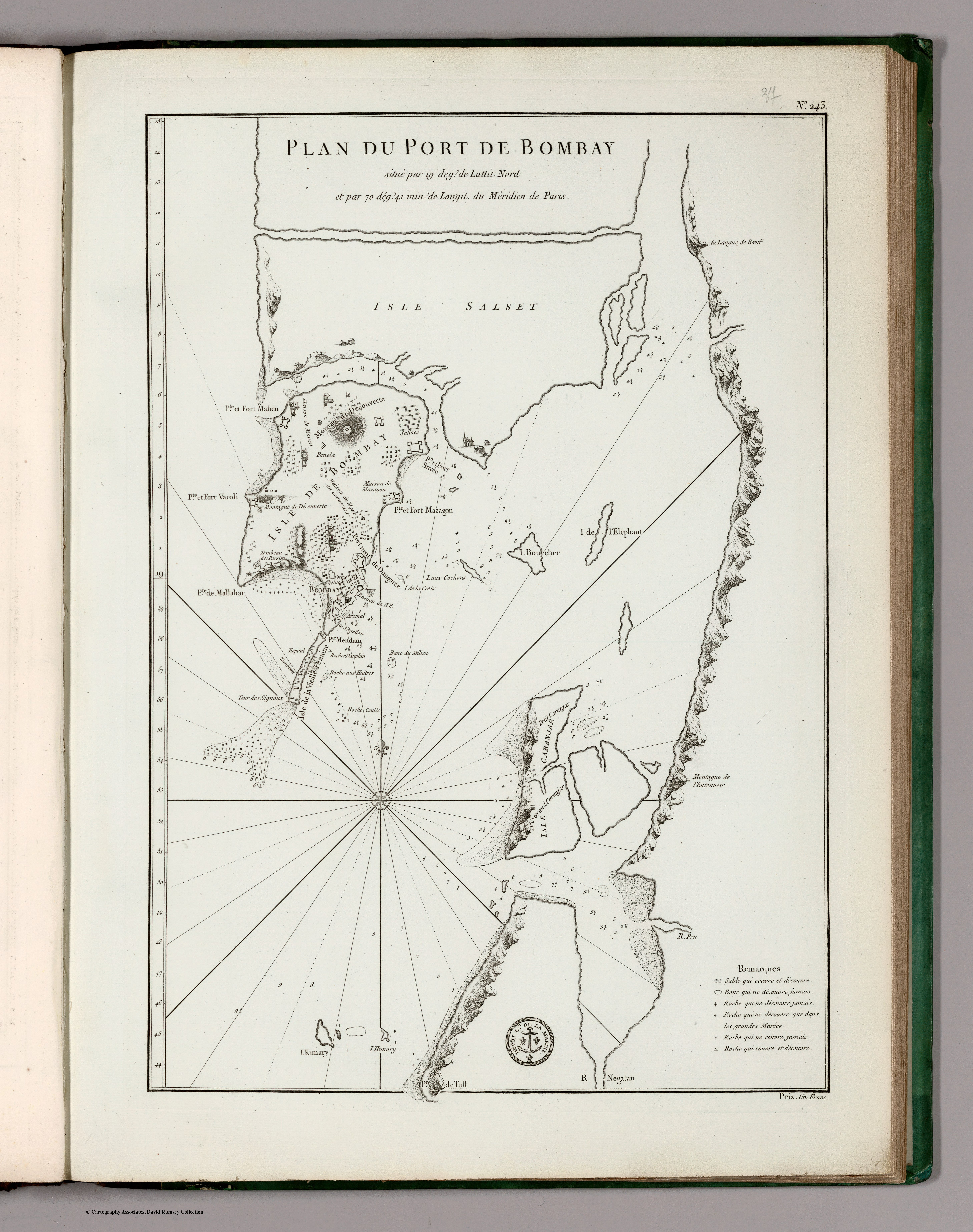
Plan du Port de Bombay
A French naval plan of Bombay harbour from the Neptune Oriental, the standard French sailing atlas of the eastern seas, here in the Dépôt de la Marine's 1810 issue. The working chart of the port, drawn to the Paris meridian for officers bound east.
Authorship and object
The Neptune Oriental was the great work of Jean-Baptiste d'Après de Mannevillette (1707–1780), the foremost French hydrographer of the eastern oceans; first published in 1745 and enlarged in 1775, it was maintained and reissued by the Dépôt Général de la Marine, this state updated to 1810. Depths by soundings, relief pictorial, prime meridian Paris.
A pilot's document
This is a port plan in the strict sense — the approaches, anchorage and soundings of Bombay harbour, with explanatory notes, made so that a ship's officer could bring a vessel in and out. It belongs to the navigational apparatus of long-distance trade and war.
The gaze
Half a century after Bellin, France was still charting Bombay's waters with care, and for the same reason: the harbour was a fixed point in the contest for the East. The map sees India from the deck and the chart-table — a coastline reduced to depths, bearings and safe water.