← Home Ground Bombay and Deccan
 Click to enlarge
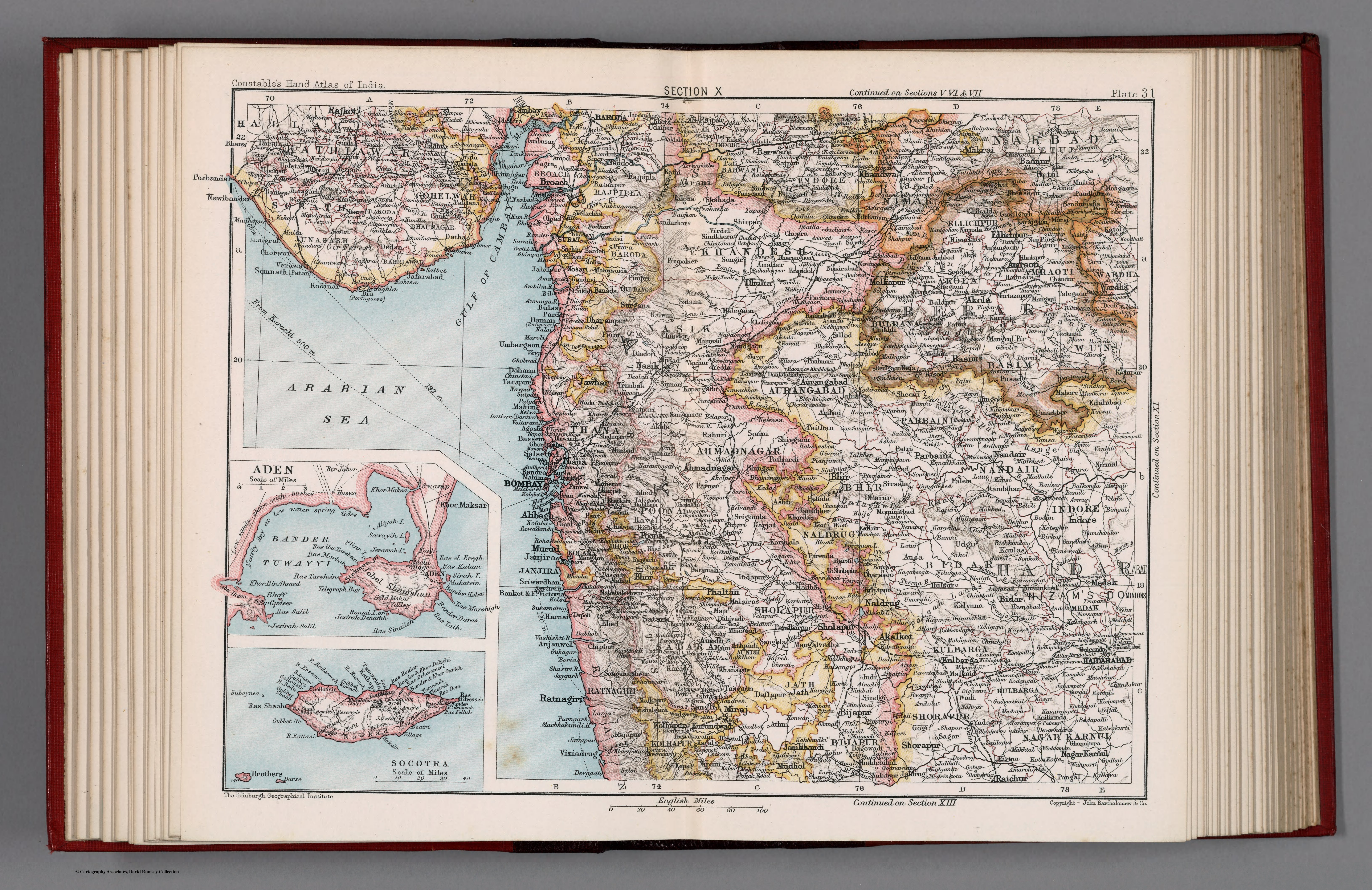
Section X. Bombay, Berar. Plate 31
The Bombay-and-Berar regional sheet from Constable's Hand Atlas of India, prepared under J.G. Bartholomew from the Ordnance and Great Trigonometrical surveys. The administered province, drawn with late-Victorian scientific precision.
Authorship and object
Plate 31 of Constable's Hand Atlas of India (London, 1893), a new series of sixty maps prepared at the Edinburgh Geographical Institute under John George Bartholomew (1860–1920) from the Ordnance Survey and other surveys. Colour, administrative boundaries, relief by hachures and spot heights, at about 1:5,500,000.
Survey made atlas
Bartholomew's atlas rests directly on the completed Indian surveys — the labour of Lambton and his successors now distilled into clean, authoritative reference maps. This sheet presents the Bombay Presidency and the province of Berar as administrative units, their boundaries, towns and routes precisely fixed.
The gaze
This is India as fully governed territory: the province defined by its administrative borders, mapped to a scientific standard, presented for the official and the educated public alike. The romance is gone; what remains is the calm, exact depiction of a dominion whose geography is now settled fact.