 Click to enlarge
India orientalis
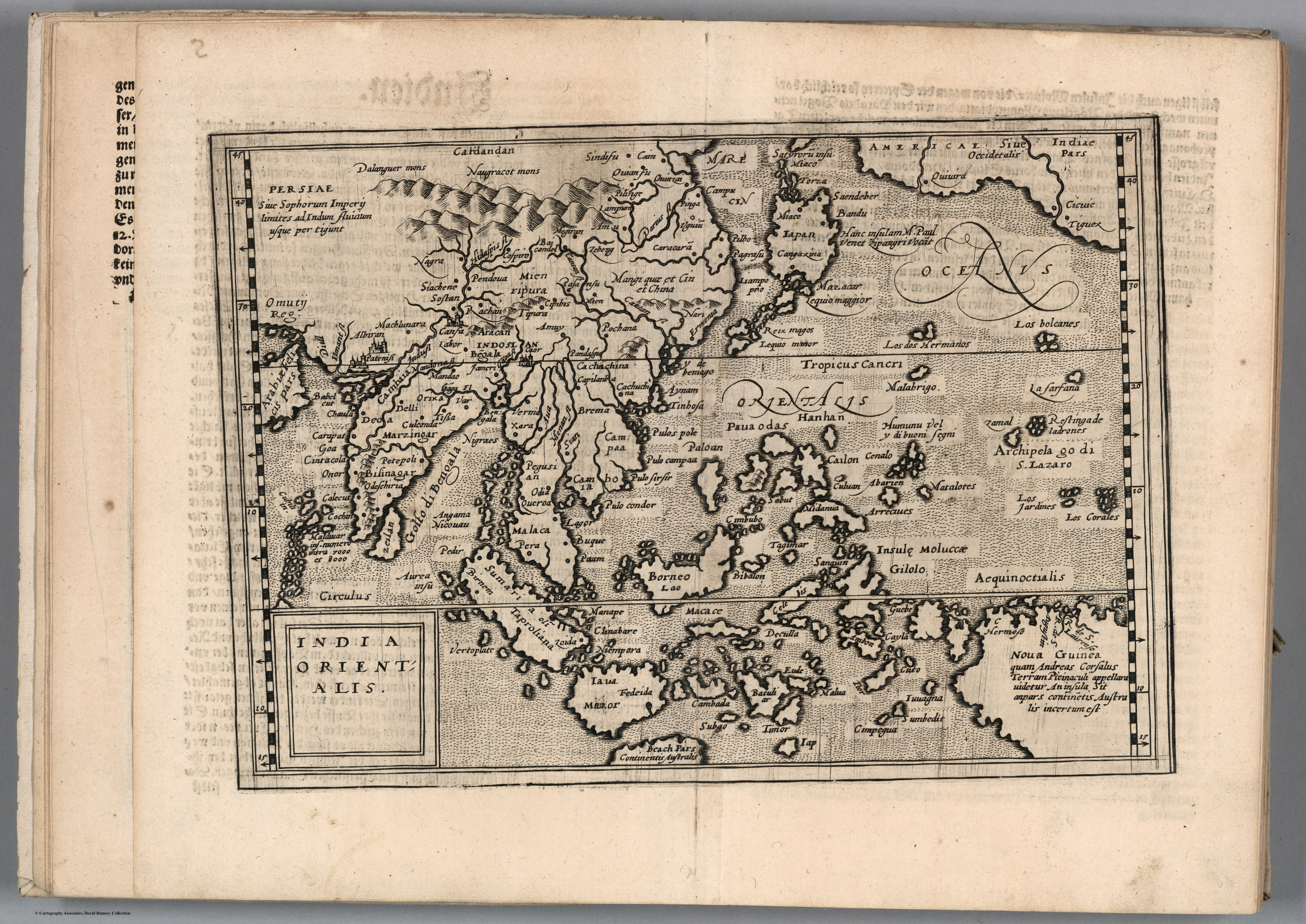
A compact map of the East Indies from Matthias Quad's Geographisch Handtbuch (Cologne, 1600), the first atlas originally written in German. A reduced, affordable derivative of the great folio atlases, it shows how the Ortelian image of India spread downmarket into the hands of ordinary readers.
Authorship and object
Quad (1557–1613), a Cologne engraver trained in the Netherlands, produced small pocket atlases as cheaper alternatives to the folios of Ortelius, Mercator and De Jode. The Geographisch Handtbuch of 1600 gathered eighty-two maps and was the first atlas composed in German from the outset.
A derivative by design
Quad's plates are reduced copies of those larger atlases — this India Orientalis descends directly from the Ortelian model of the region — distinguished chiefly by his habit of embellishing the sheets with figures, scenes and portraits. Its interest is not as a source of new geography but as evidence of how that geography circulated.
The gaze
This is India at one remove and one price-point down: the established European picture of the East Indies, copied and made portable. It marks the moment the subcontinent's image became a popular commodity — standardised, repeated and circulated well beyond the courts and merchant houses that commissioned the originals.