← Baroque Mughals and Companies
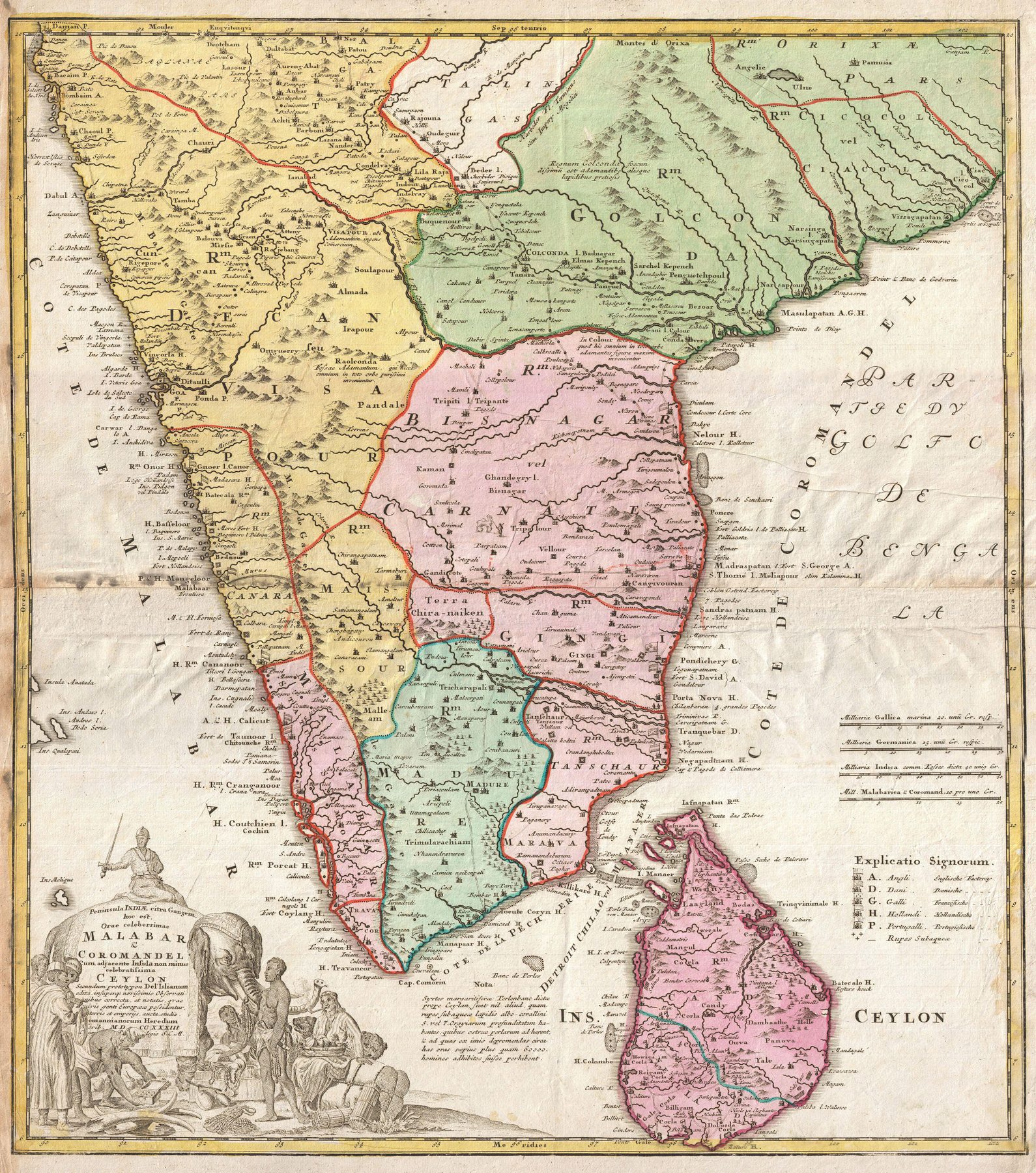
Malabar, Coromandel and Ceylon
A coloured atlas map of the southern peninsula and Ceylon, organised around the celebrated Malabar and Coromandel coasts. Geographic compilation, commercial interest and elaborate ornament are combined into a saleable image of maritime South India for the European atlas market.
Authorship and object
The sheet is dated 1733 and belongs to the Nuremberg publishing tradition associated with Johann Baptist Homann and continued by his heirs after his death. Its Latin title — Peninsula Indiae citra Gangem … Malabar & Coromandel … Ceylon — announces the peninsula through the two coasts best known to European trade, with Ceylon set alongside it. The Rumsey copy is a coloured engraving measuring approximately 55 by 48 centimetres, at about 1:3,000,000.
Two commercial coasts
The map’s conceptual axis is maritime. “Malabar” and “Coromandel” are not incidental regional names but the trading fronts by which European companies encountered the peninsula: pepper and ports on the west, textiles and settlements on the east. Inland kingdoms, rivers and towns fill the space between them, but the shape of knowledge remains strongest where ships, merchants and printed sources had travelled.
Ornament as atlas argument
Colour separates territories and an elaborate title cartouche converts the map into a visual commodity. Such ornament does not sit outside the geography. It tells the purchaser how to see the sheet: distant places made abundant, picturesque and available for learned inspection. The figures and emblems belong to European conventions of representing Asia rather than to neutral ethnographic description.
The gaze
Compared with d’Anville’s later austerity, the Homann sheet is confident and crowded. Knowledge gathered through navigation, trade and earlier maps is republished as a comprehensive atlas image. India is a peninsula of named coasts, states and commodities — geographically informative, commercially oriented and theatrically framed for a European reader who need never visit it.
Source and image
David Rumsey Historical Map Collection, List No. 9753.097: catalogue record and zoomable image. Reuse of the digital image remains subject to the source collection’s terms.