← Baroque Mughals and Companies
 Click to enlarge
Composite: l'Inde
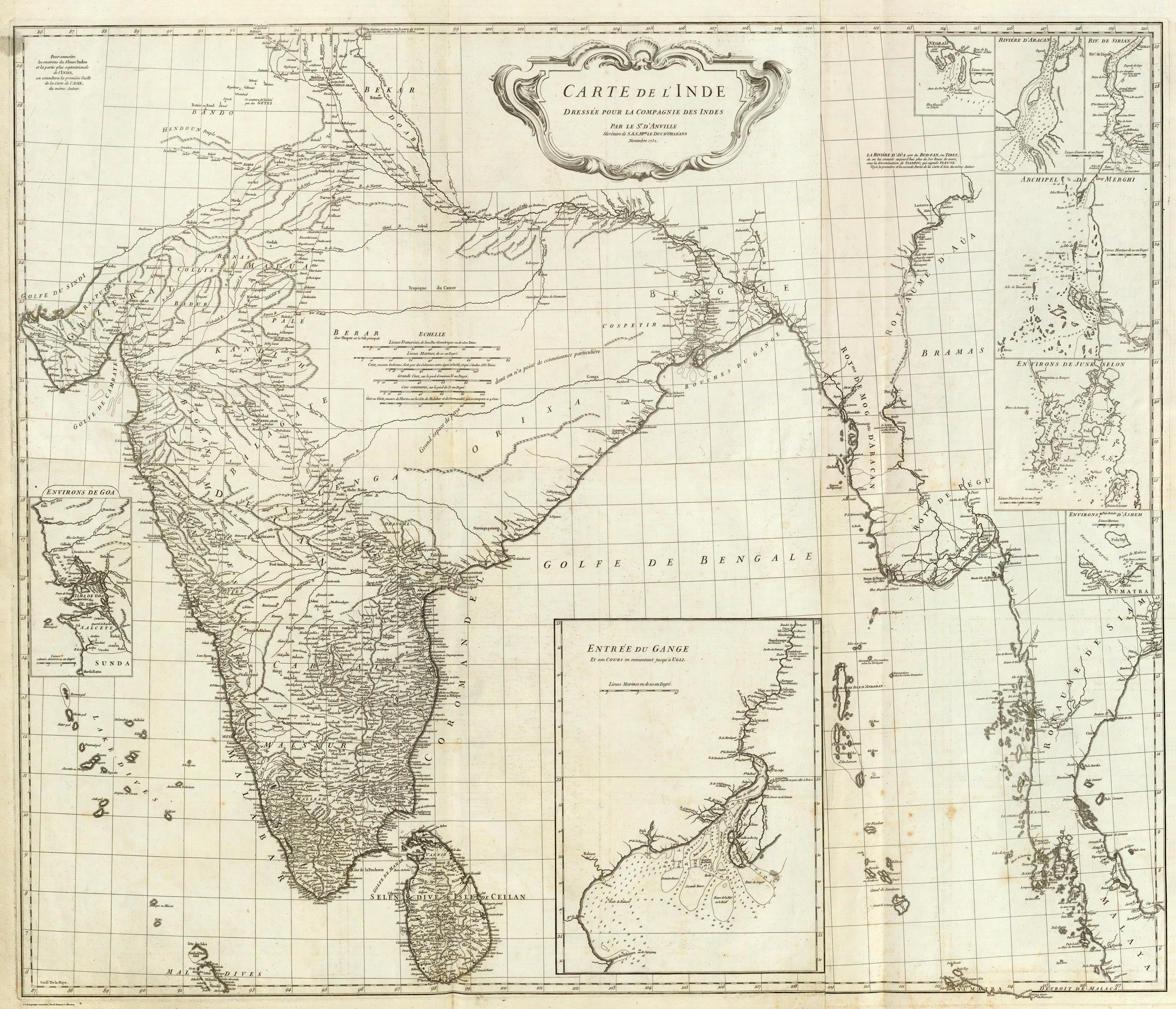
Jean-Baptiste Bourguignon d'Anville's Carte de l'Inde, drawn for the French Compagnie des Indes in 1752, is the most rigorous map of the subcontinent produced before the British surveys — and the period's clearest statement of cartography as critical scholarship rather than decoration.
Authorship and object
D'Anville (1697–1782), the foremost French geographer of his century and later premier géographe du roi, compiled the map in Paris for the Compagnie des Indes; it was engraved by Guillaume Delahaye, with an ornamental cartouche after Gravelot. It was issued on two sheets, here joined, at a scale of roughly 1:3,100,000.
Method — compilation as criticism
D'Anville never set foot in India. His method was the critical evaluation of every available source — itineraries, route-distances, missionary accounts and astronomical fixes — weighed against one another rather than copied. Inheriting the precision-over-ornament tradition of Sanson and the empirical emphasis of the Delisles, he is often regarded as the first genuinely scientific cartographer, and the map is among the purest examples of that approach.
The honesty of the blank
The map's most radical feature is what it omits. Southern India and the coasts, well served by observation, are rendered in fine detail; the northern interior, poorly known, is left conspicuously sparse, its names thinning to bare paper. Where predecessors had invented, d'Anville left emptiness — treating an honest gap as more truthful than a decorative guess. Insets enlarge the strategically vital environs of Goa and the approaches to the Hughli River.
Significance
The map set the European standard for India at mid-century and was copied extensively. Its authority is best measured by what followed: when James Rennell came to compile his own maps a generation later, he worked with and checked against d'Anville's sources directly. This is the high-water mark of the subcontinent drawn from the outside — by reason and report — on the eve of its being drawn from within by survey.