 Click to enlarge
Composite: India peninsula
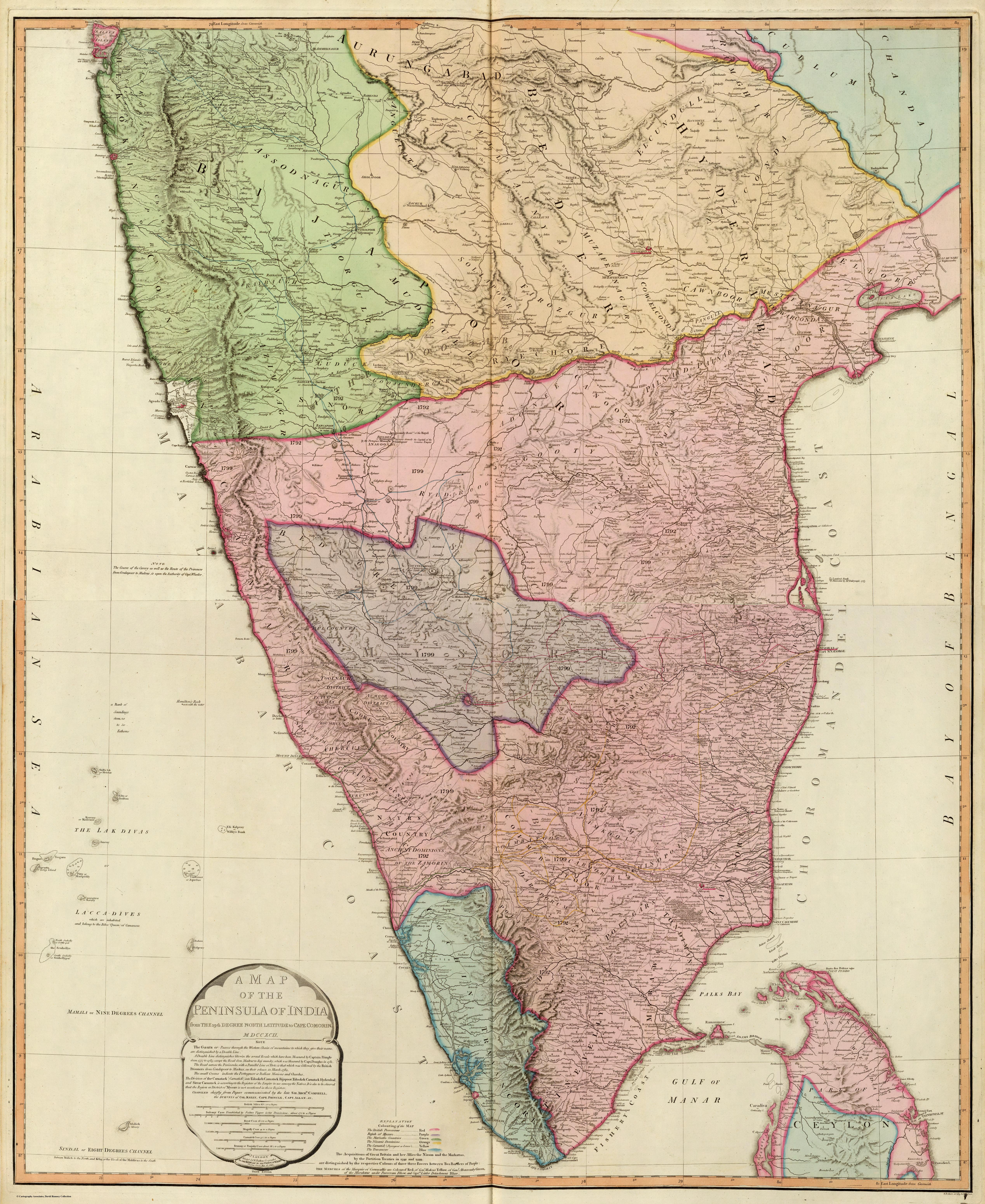
The two-sheet Map of the Peninsula of India to Cape Comorin as issued in Faden's General Atlas — the 1792 survey map carried forward into the standard British atlas, fully coloured and extended over northern Ceylon.
Authorship and object
A later state of Faden's peninsula map (plate dated 1792), here in full hand-colour on two sheets and bound into his General Atlas of 1811; it reaches south to take in the northern part of Ceylon.
From campaign sheet to atlas plate
The same detailed southern survey now sits within a general atlas — the working military map absorbed into the reference cartography of the age. By the time of this state, after the fall of Seringapatam in 1799, the south it depicts was substantially under British control.
The gaze
The map's journey from separate survey sheet to atlas plate mirrors the larger story: hard-won survey knowledge of a contested region settling, within a few years, into the calm coloured image of an India increasingly held.