Room 03
The Survey Turn
After Plassey the gaze changes hands and character. With Rennell and the surveyors, India stops being a thing reported and becomes a thing measured — drawn from inside the country by men walking it with chain and theodolite, in the service of a Company that means to govern. Decoration retreats; the grid advances. To map becomes to possess.
 Composite: (Sheets 1 and 2) Hindoostan by J. Rennell F.R.S. 17821781
 Hindoostan Mogul Empire SurveyOfIndia1788
 Composite Map: 99-100B. Neueste Karte von Hindostan Bengalen1788
 Mappa geogr. Indiæ Orients eller geogr. charta öfver Ostindien1789
 Composite Map: A map of the Peninsula of India from the 19th degree north latitude to Cape Comorin1792
 Composite: India peninsula1800
 A New and Accurate Map of the Southern Province of Hindoostan1800
 Composite: (Sheets 1-3) Map of the Province of Malabar, Drawn from Various Surveys By A. Arrowsmith1809
 Sheet 1) Map of the Province of Malabar, Drawn from Various Surveys By A. Arrowsmith1809
 India1820
 Composite: Carte Generale des Indies1825
 Hindoostan1827
 Composite: (North and South) This Newly Constructed Map of India From The Latest Surveys of the best Authorities1831
 GTS Index1922
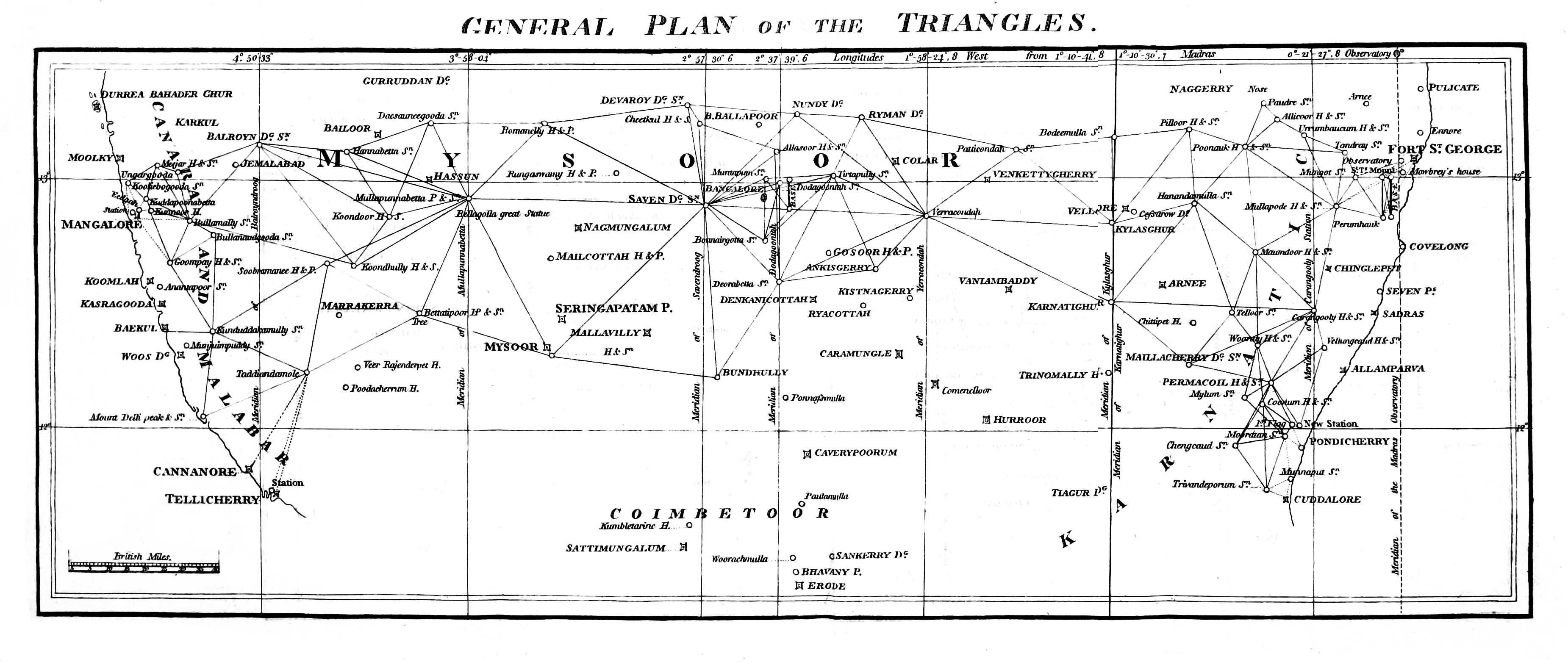 Peninsula Triangulation Asiatic Researchesc1820