← Home Ground Bombay and Deccan
 Click to enlarge
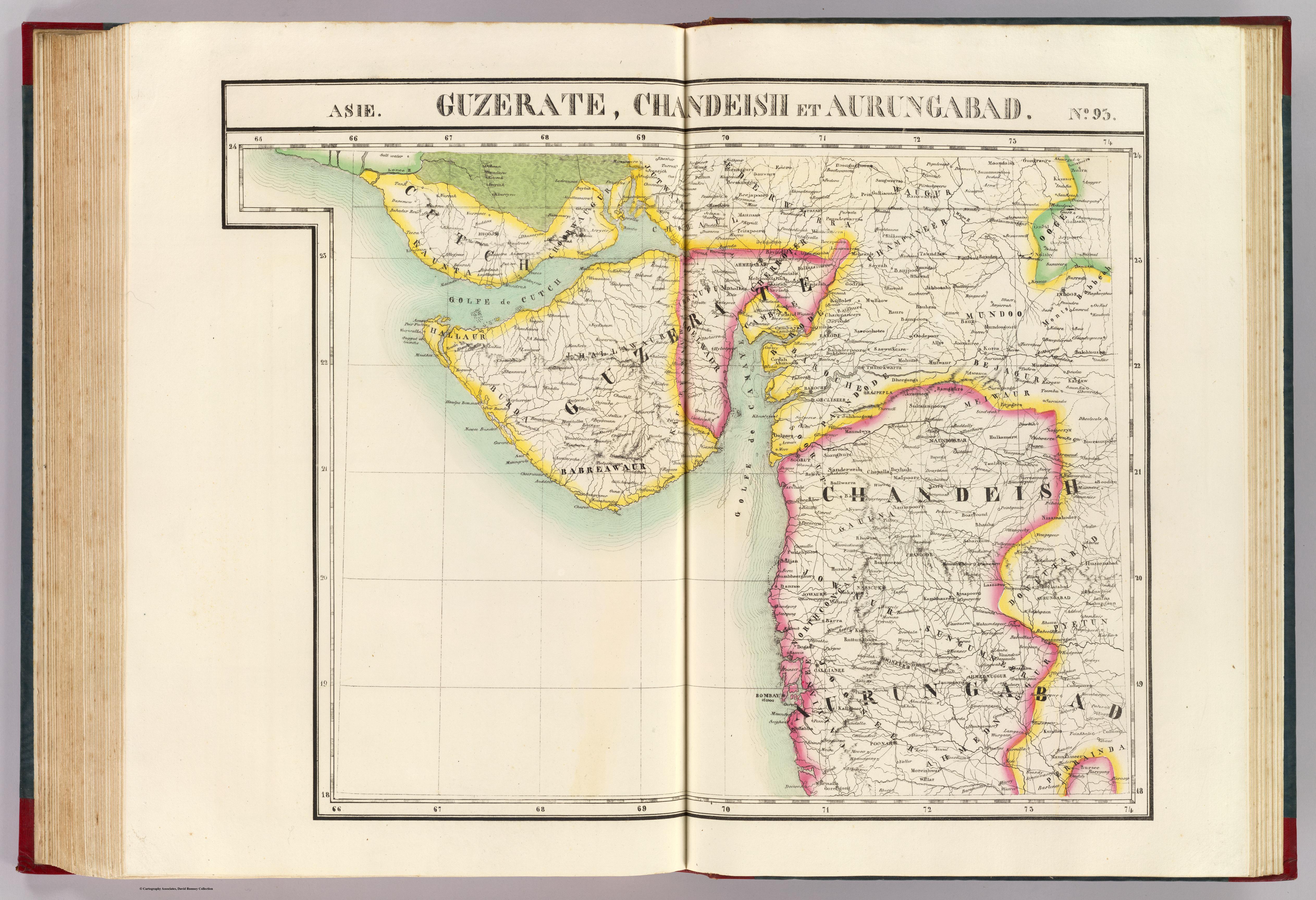
Guzerate, Chandeish et Aurungabad. Asie 93
The companion sheet of the northern Deccan — Gujarat, Khandesh and the Aurangabad country — from the same single-scale, lithographed Atlas Universel. India here is one piece of a seamless cartographic globe.
Authorship and object
Philippe Vandermaelen (1795–1869) of Brussels issued his Atlas Universel in 1825–27 as a monumental novelty: every sheet of the whole world at the identical scale of about 1:1,641,836, lithographed rather than engraved. Joined, its sheets would form a globe nearly eight metres across; one was in fact built in Brussels. Hand-coloured lithograph; prime meridian Paris.
A piece of a uniform world
Because every region was mapped at the same large scale, the Deccan is treated exactly as Europe or America — not a remote whole but a set of standard tiles, this one covering Gujarat, Khandesh and Aurangabad, with statistical notes continued across adjoining sheets.
The gaze
Vandermaelen's project embodies a new ambition: to hold the entire earth in one consistent system, every part commensurable with every other. India ceases to be a special, distant subject and becomes simply more world, sliced to the same grid — the universalising gaze of nineteenth-century systematic geography.