← Administered Empire and Victorian Atlas
 Click to enlarge
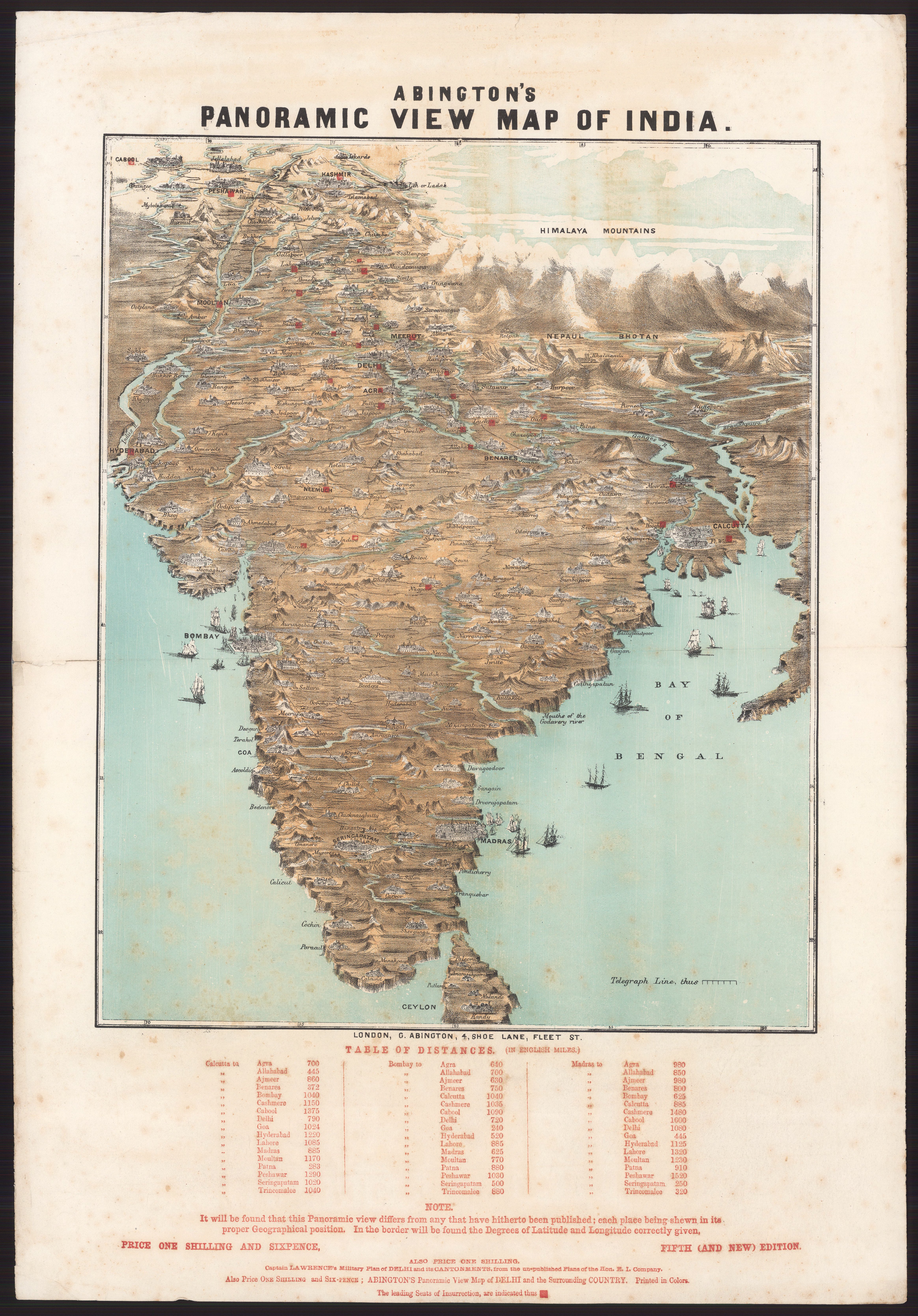
Abington’s Panoramic View of India
G. Abington's colour-printed Panoramic View of India — a popular pictorial bird's-eye map, in its fifth edition, that marks "the leading seats of insurrection" of the 1857 Rebellion. India rendered as dramatic spectacle for a British public gripped by the Mutiny.
Authorship and object
A single-sheet, colour-printed wood-engraved panoramic view published by G. Abington in London (c.1858), about 555 × 380 mm; this is the fifth edition. Despite many printings it is now rare, held among institutions only by the Bodleian and the National Library of Wales.
A map as news and theatre
Rather than a conventional plan, the sheet adopts a tilted bird's-eye perspective that dramatises the subcontinent in three dimensions. Its purpose was topical: it flags the principal centres of the 1857 uprising for a readership following the crisis from home.
The gaze
This is the imperial public's gaze in a moment of shock. The Rebellion made India suddenly vivid and alarming to Britons, and Abington answered with a sheet that is part news-graphic, part spectacle — the empire's great crisis packaged as a dramatic panorama to be pinned up and pored over. India is seen here as event and emotion, not merely territory.