Room 05
Administered Empire and Victorian Atlas
At the height of empire the gaze turns analytic. India is no longer merely outlined but dissected — into presidencies and districts, densities of population, lines of rail and telegraph. The thematic maps of high-Victorian cartography render the subcontinent as an object of administration and knowledge: something to be counted, coloured and managed.
 Map of the Northern Part of the Punjab and of Kashmir1846
 Overland Route To India1851
 Southern India Including The Presidencies Of Bombay & Madras1851
 India XI1856
 Hindoostan1857
 Abington’s Panoramic View of India1858
 Südost-Asien1866
 India 111883
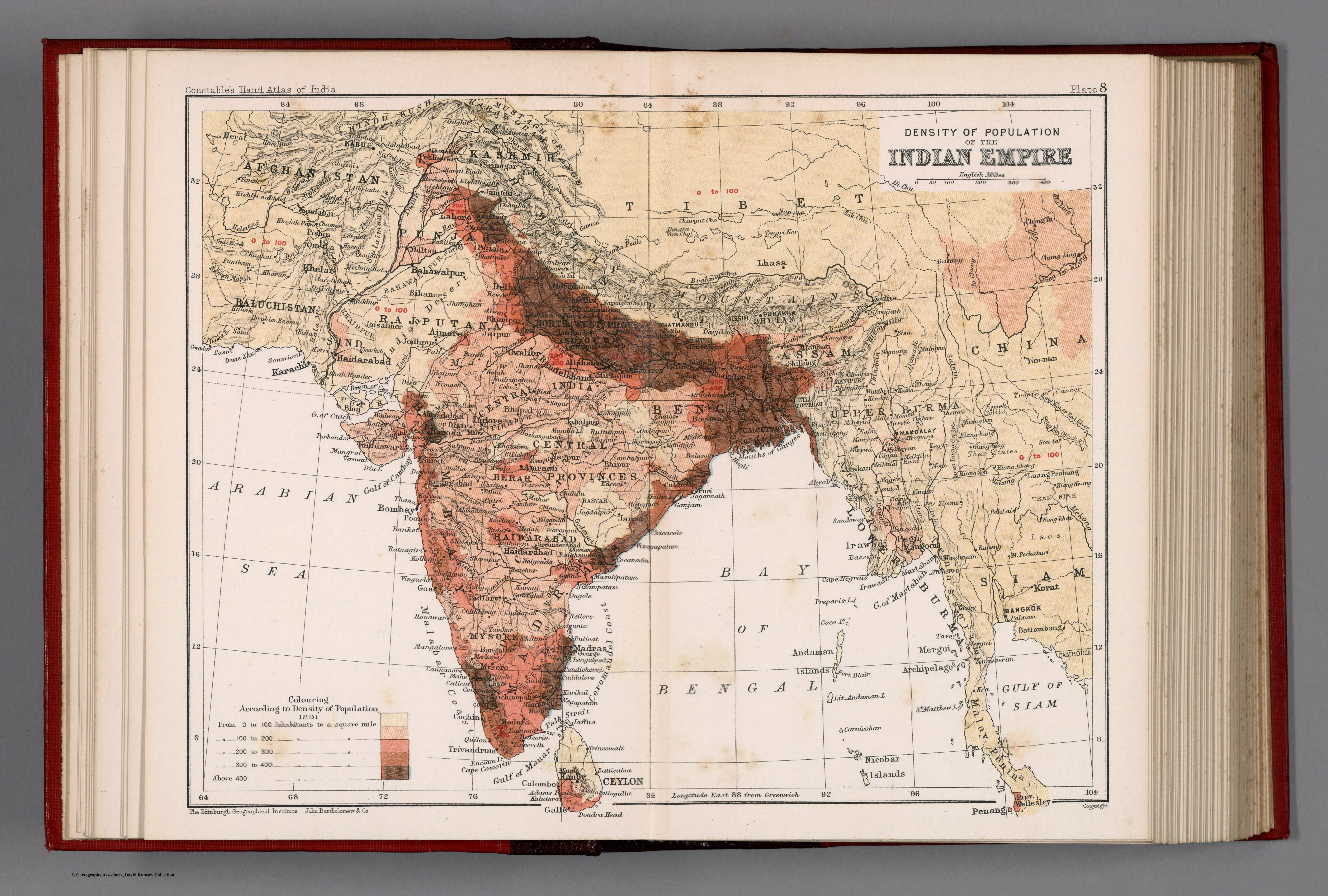 Density of population of the Indian Empire. Plate 81893
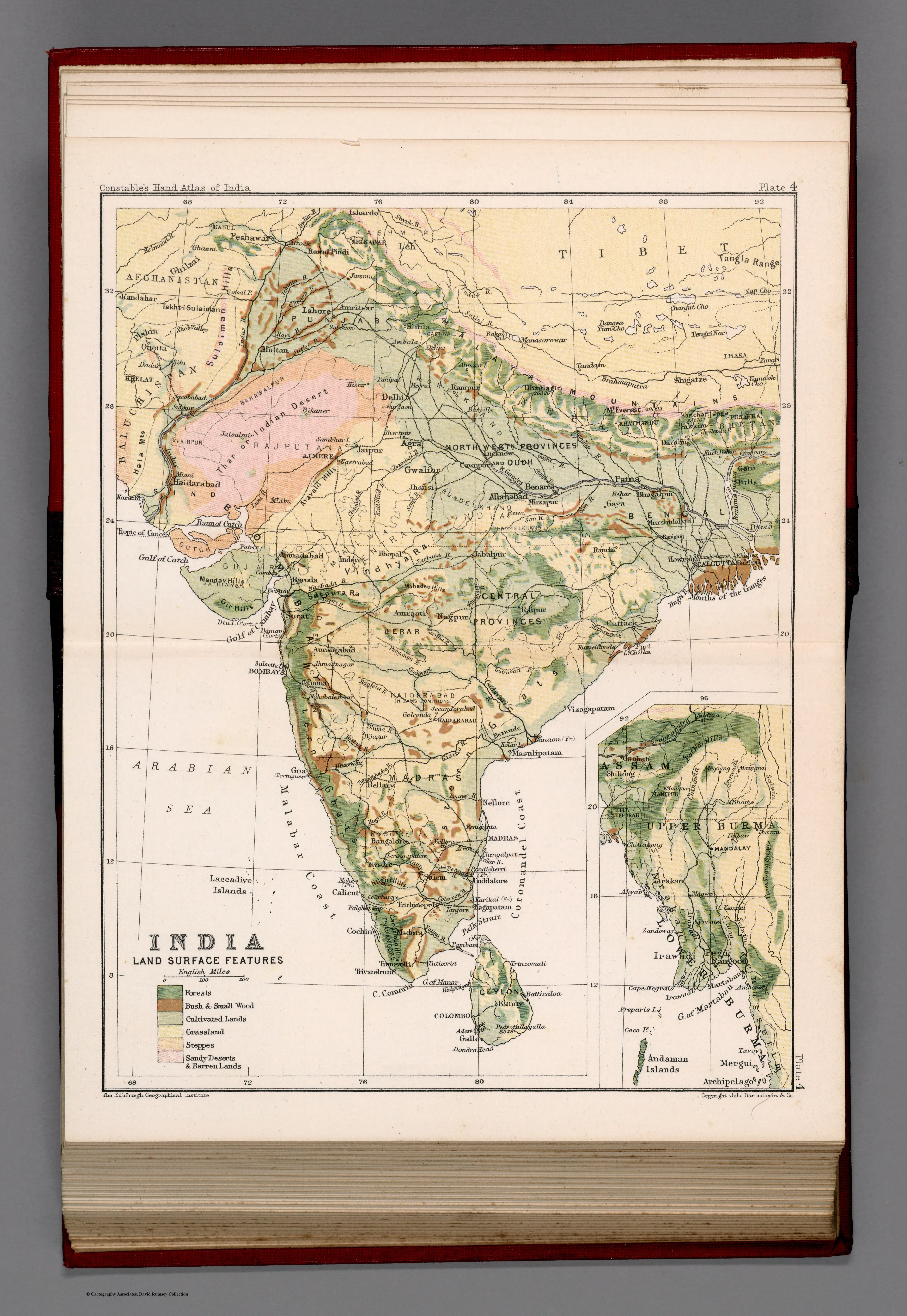 India : Land surface features. Plate 41893
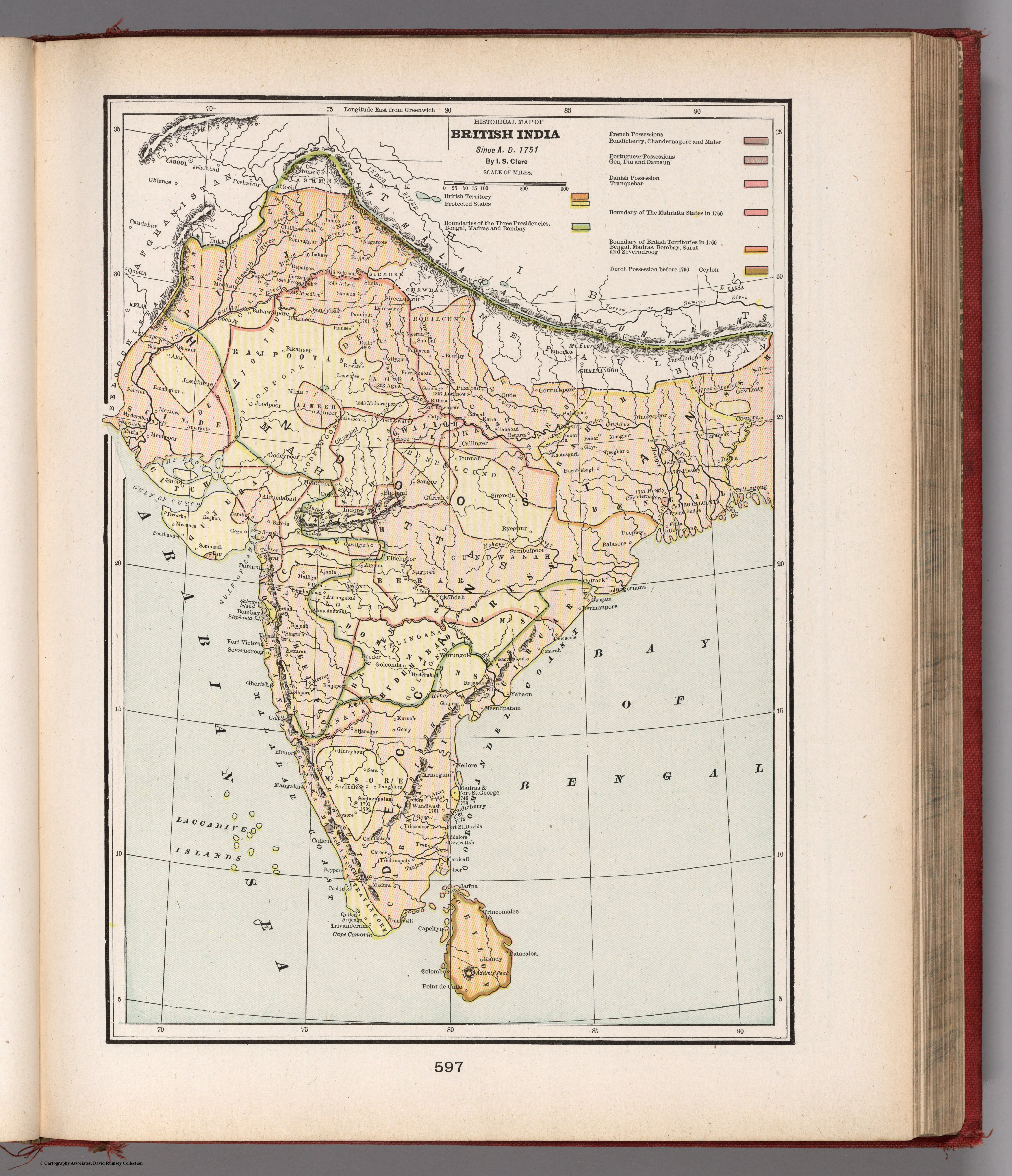 Historical map of British India. Since A.D. 17511901