← Administered Empire and Victorian Atlas
 Click to enlarge
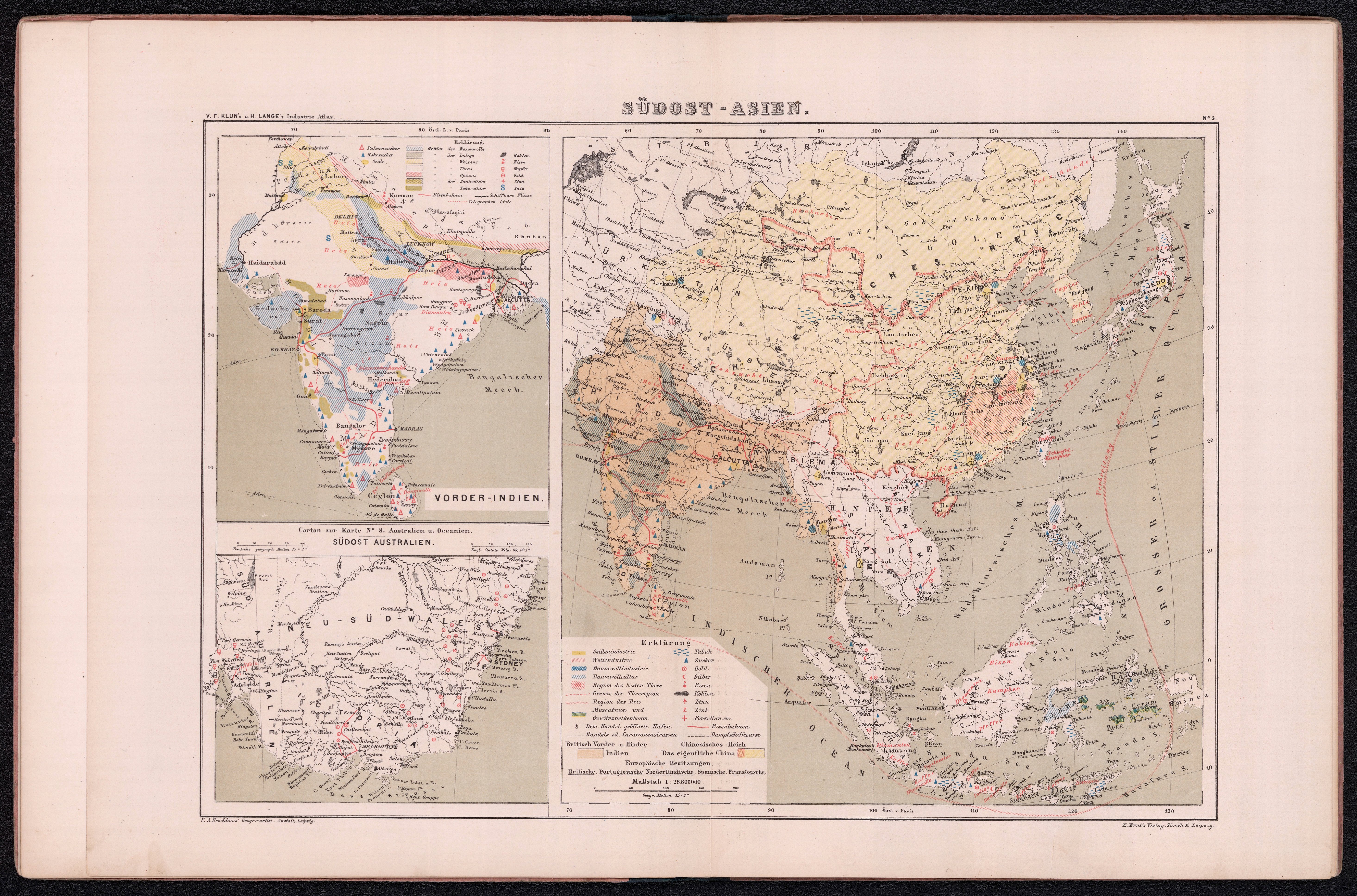
Südost-Asien
A map of Southeast Asia, taking in India's eastern flank, from a German-language Atlas of Industrial and Commercial Geography. India and its neighbours seen through the analytic lens of trade, railways and statistics.
Authorship and object
From the Atlas zur Industrie- und Handelsgeographie of V. F. Klun — professor of geography and statistics at the Vienna Commercial Academy — and Henry Lange, engraved at the Brockhaus institute and published by E. Ernst (Zurich and Leipzig, c.1866). Made expressly for commercial and technical schools, and for merchants and industrialists.
Geography as commerce
The atlas's premise is that geography should serve trade. This sheet maps the region with attention to railways, communications and commercial relevance, accompanied by explanatory statistical text — India as a node in a global economy rather than a political possession.
The gaze
Here the gaze is explicitly economic, and continental-European rather than British. India appears as part of a commercial system to be analysed by a merchant or an engineer, its value measured in routes, resources and trade. It is the administered subcontinent abstracted into the data of industry and commerce.