← Home Ground Bombay and Deccan
 Click to enlarge
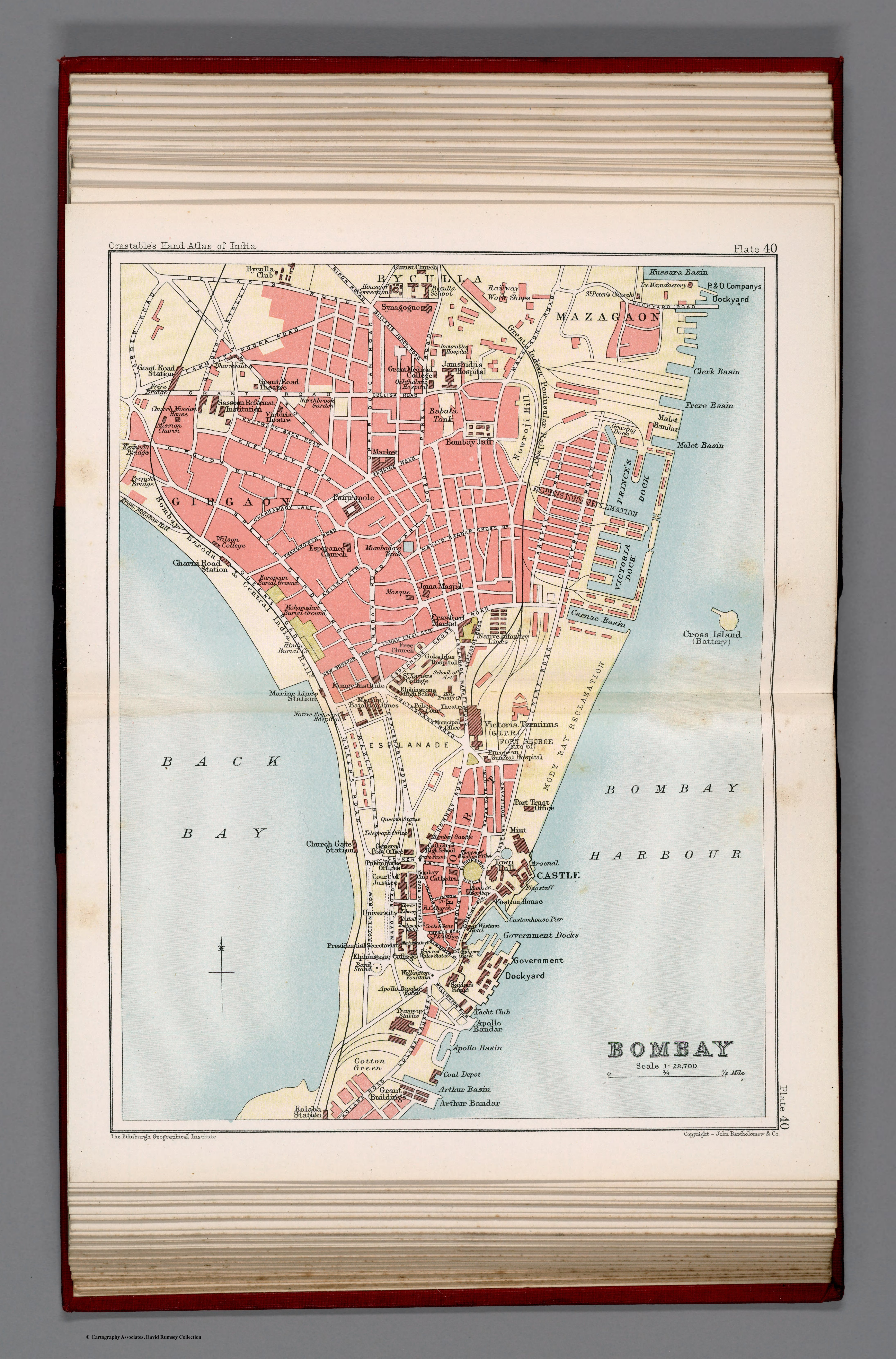
Bombay. Plate 40
A street plan of the city of Bombay from Constable's Hand Atlas of India — the imperial city at its finest scale, down to its blocks, parks, police stations and public buildings. The narrowing gaze of this collection reaches its closest point: the governed city itself.
Authorship and object
Plate 40 of Constable's Hand Atlas of India (Bartholomew, 1893), a coloured city plan at about 1:28,700 — the largest scale in this room. It shows streets and city blocks, parks, the post office, police stations, landmarks and public buildings, with the island's watercourses and canals.
The administered city
A plan at this scale is an instrument of urban governance. The marking of police stations, post offices and civic buildings turns the map into a tool for administering, policing and servicing a major colonial city — the apparatus of rule rendered street by street.
The gaze
From the 1519 ocean to a Bombay street grid: this is the European gaze at its most intimate and most controlling. The same drive that once filled blank interiors with conjecture now numbers the city's blocks and locates its police stations. To map Bombay this finely was to hold it in administrative hand — the home ground known, at last, down to the street corner.