← Administered Empire and Victorian Atlas
 Click to enlarge
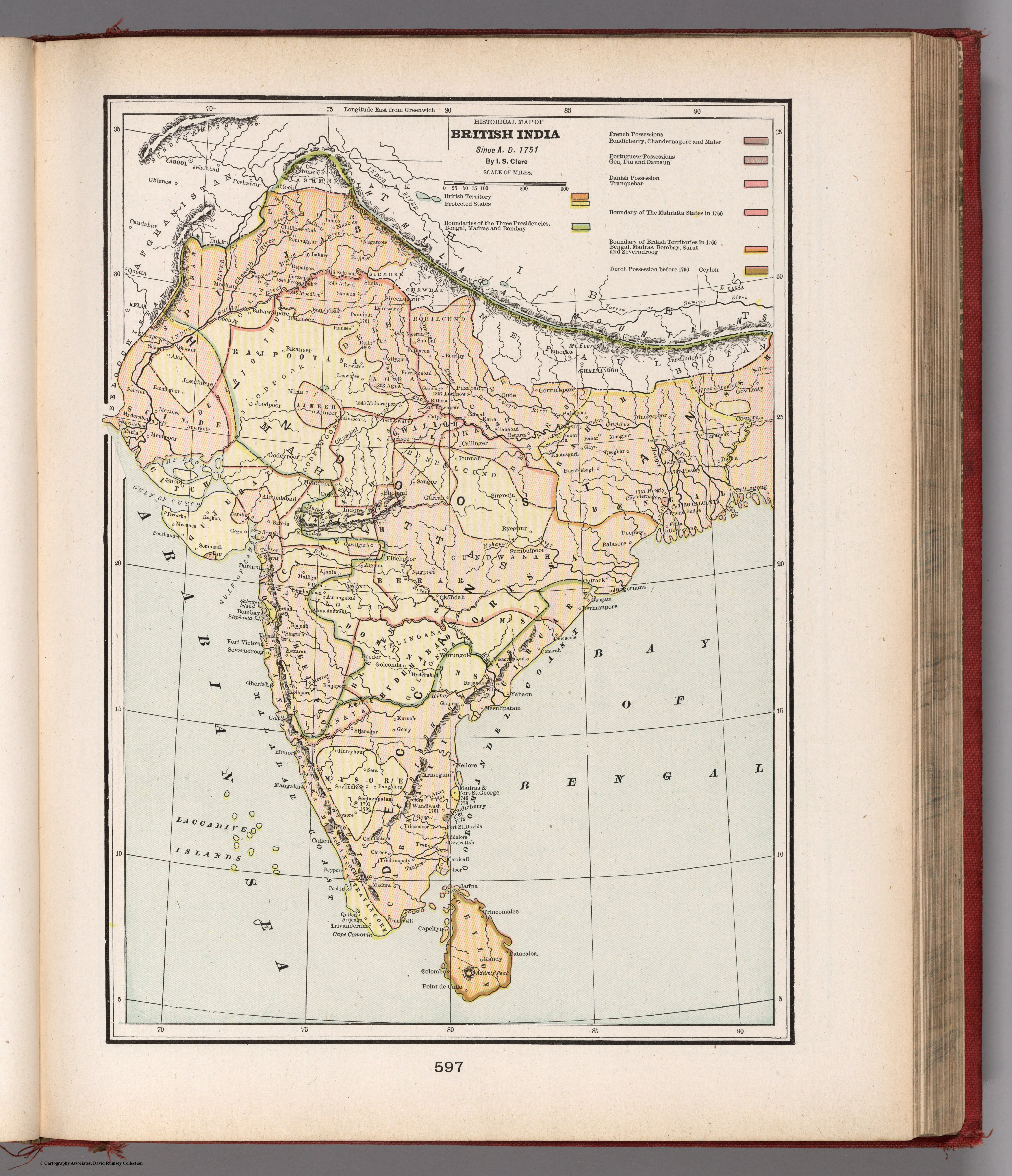
Historical map of British India. Since A.D. 1751
An American historical map narrating the growth of British India since 1751, from Cram's Atlas of the World. India presented not as place but as story — the chronicle of European, and finally British, conquest.
Authorship and object
"Historical Map of British India. Since A.D. 1751," by I. S. Clare, in Cram's Atlas of the World, Ancient and Modern (G. F. Cram, New York and Chicago, new census edition, 1901). Lithographic colour, relief by hachures, prime meridian Greenwich; it distinguishes British, French, Portuguese and Dutch possessions.
History as map
The sheet is explicitly retrospective, dating itself "since A.D. 1751" — the era of Clive and the contest for the Carnatic — and colouring the subcontinent to show the European powers' holdings and the spread of British control. Geography becomes a way of telling the history of conquest.
The gaze
By 1901 the European acquisition of India could be presented, even in an American atlas, as a finished historical narrative — a process with a beginning in 1751 and a settled end in the British Empire. The map closes the room as it closes a story: India comprehended as the past tense of its own subjugation, the conquest now safely history.