← Administered Empire and Victorian Atlas
 Click to enlarge
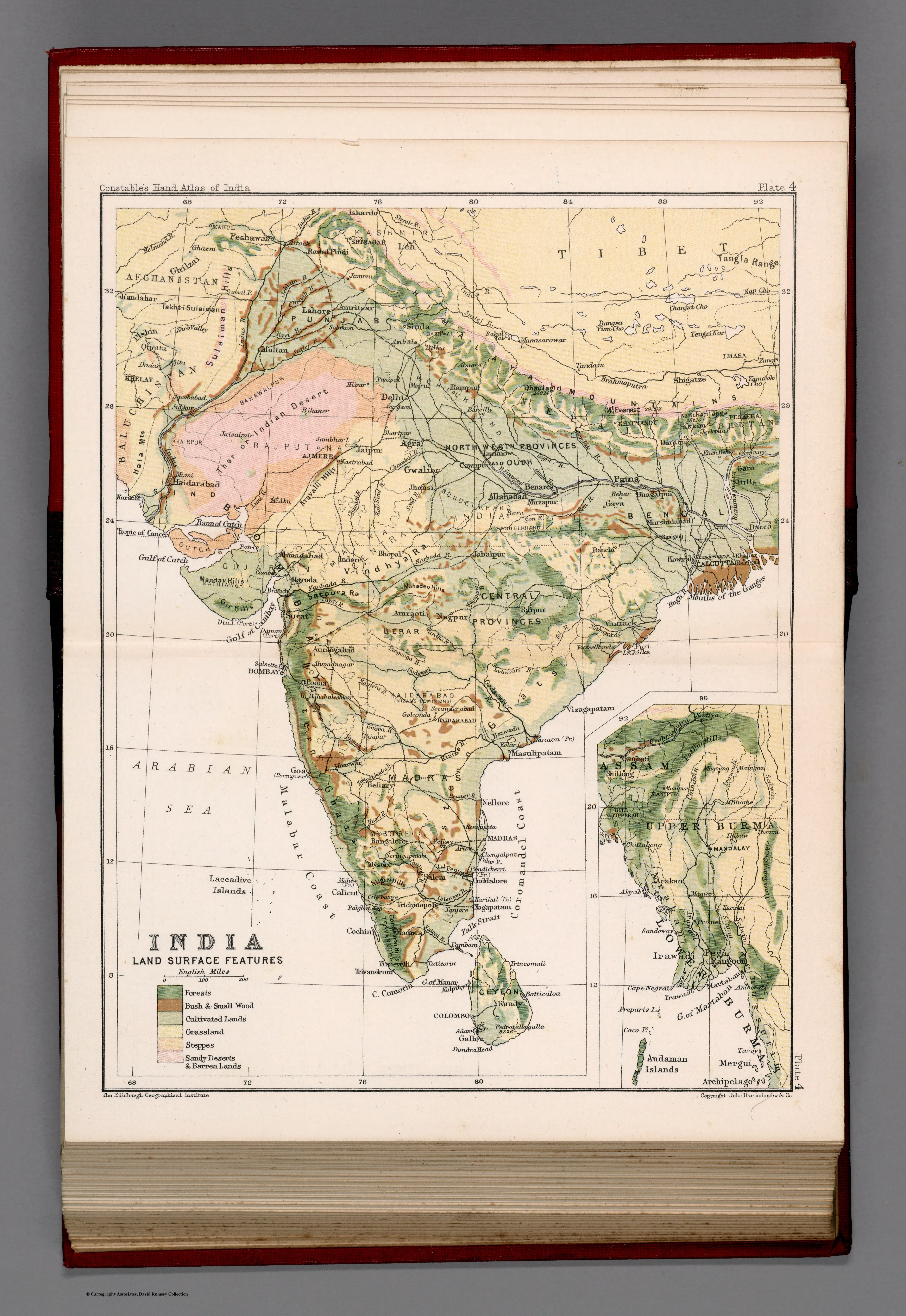
India : Land surface features. Plate 4
A physical-geography plate of India's land surface and vegetation from Constable's Hand Atlas of India — the subcontinent classified by terrain and plant cover. The same analytic gaze as the population map, turned to the natural world.
Authorship and object
Plate 4 of Constable's Hand Atlas of India (Bartholomew, 1893), at about 1:17,000,000, showing land-surface features and phytogeography with a colour key and an inset continuation map.
The scientific layer
Where the population plate mapped people, this maps the physical base — relief, surface type and the distribution of vegetation — in the manner of the new scientific geography that treated a country as a set of analysable natural systems.
The gaze
Paired with the density map, this sheet shows the late-Victorian ambition to know India completely by dissecting it into thematic layers: people here, land and plants there, each rendered as data. It is comprehension by analysis — the subcontinent taken apart into the separate sciences that the imperial atlas could reassemble at will.