 Click to enlarge
Composite: Carte Generale des Indies
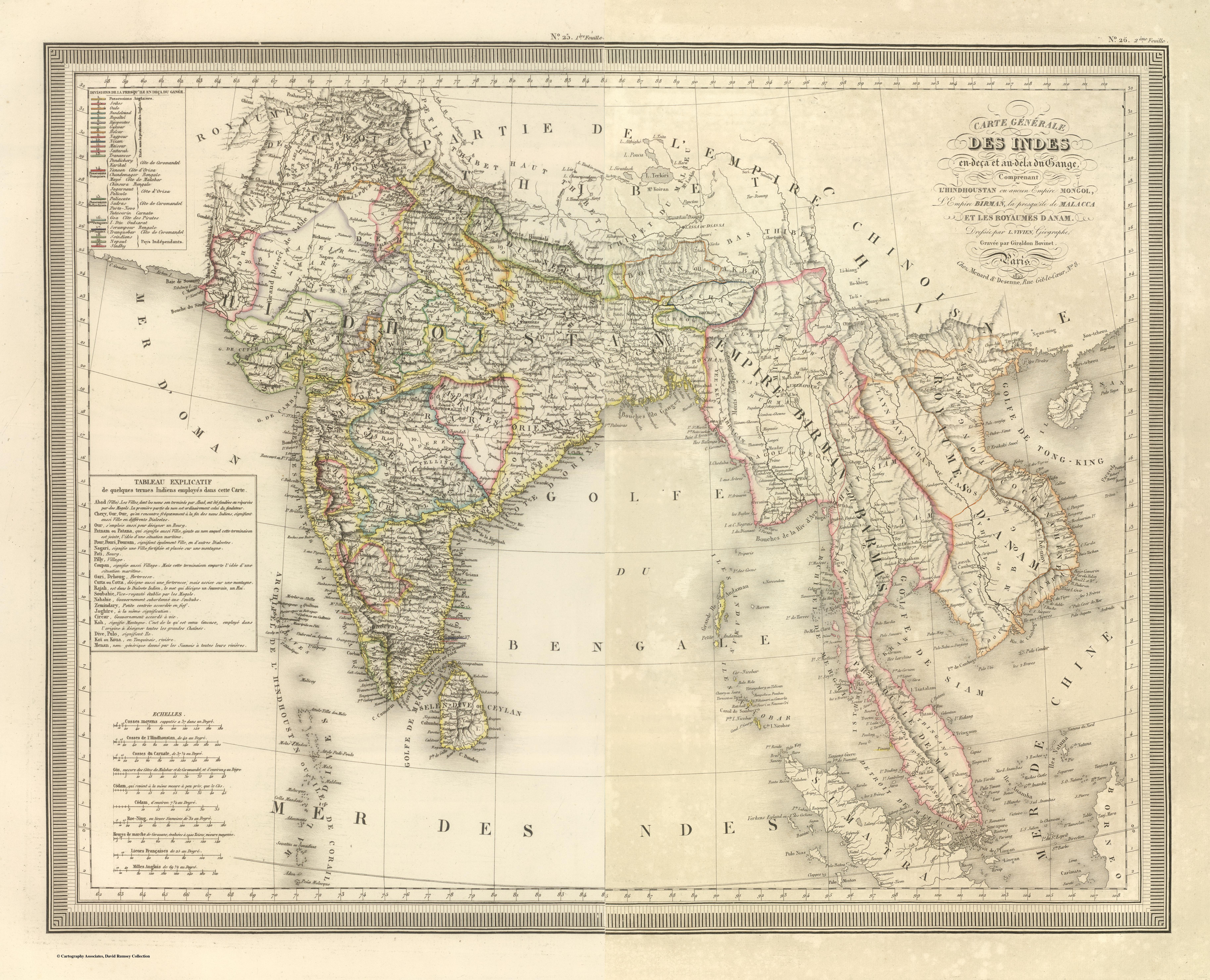
L. Vivien de Saint-Martin's Carte Générale des Indes en-deçà et au-delà du Gange, from his Atlas Universel — a polished French academic map that, even in 1825, still frames India through the old Ganges partition and the "ancient Mongol Empire."
Authorship and object
The first atlas of Louis Vivien de Saint-Martin (1802–1897), who would become a leading French geographer; published in Paris in the Atlas Universel (maps dated 1824–26). Engraved, with hachured relief and outline colour.
The old frame, finely drawn
The title still organises the subcontinent as "the Indies on this side and beyond the Ganges, comprising Hindoustan or the ancient Mongol Empire, the Burmese Empire and the Malay peninsula" — the Ptolemaic two-Indias scheme and the Mughal label both persisting in French learned geography even as British survey was redrawing the ground.
The gaze
The map shows the continental, scholarly French tradition running in parallel to the British survey — accurate, elegant and a little conservative, holding to inherited categories. It is India as the French academy still preferred to see it: a region of historic empires, comprehended whole from Paris.