← Administered Empire and Victorian Atlas
 Click to enlarge
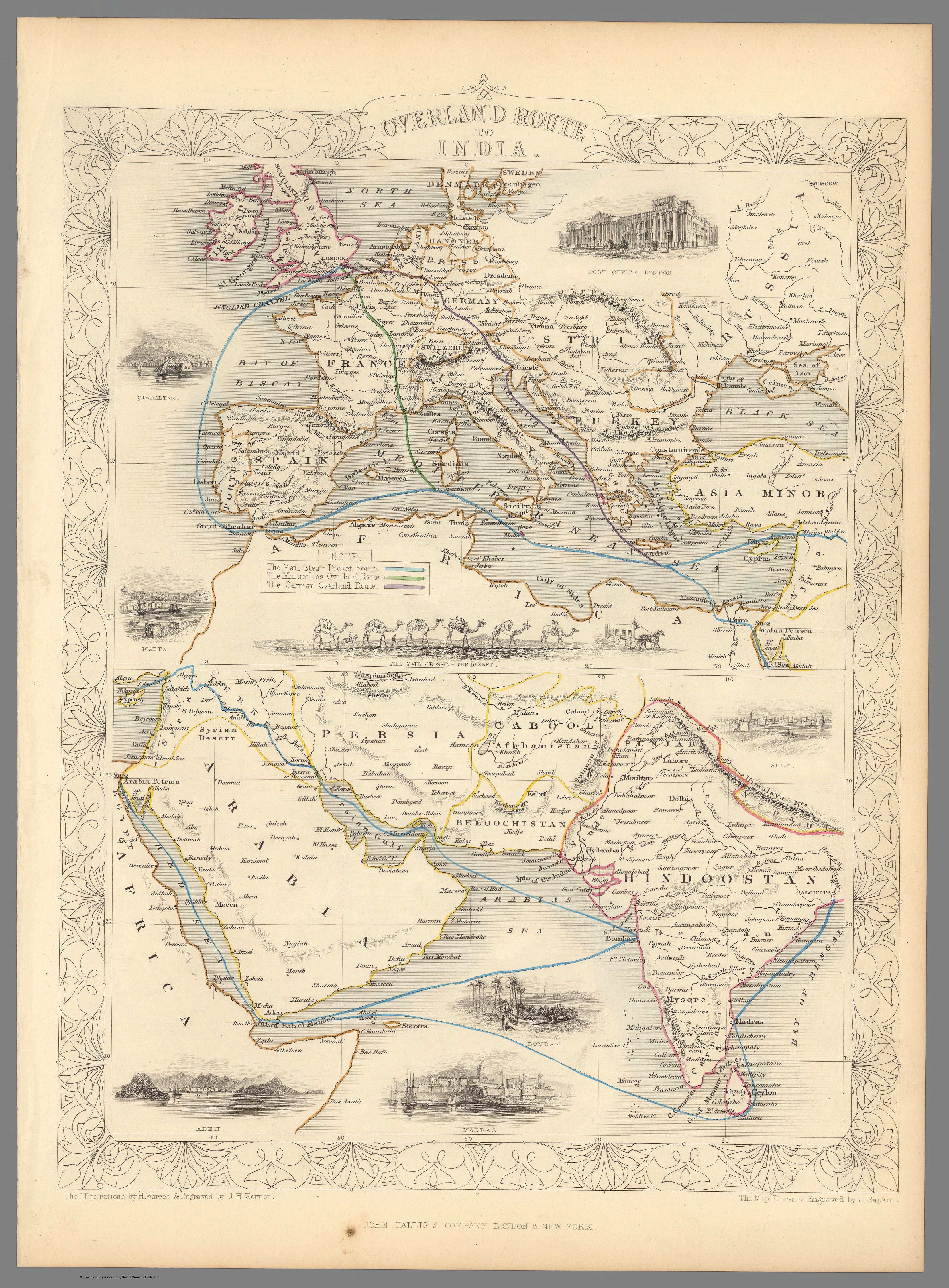
Overland Route To India
A decorative double map of the "Overland Route to India" from Tallis's Illustrated Atlas, tracing in colour the ways from Europe to India by land and sea. The Victorian preoccupation with the passage home, rendered as imperial infrastructure.
Authorship and object
From The Illustrated Atlas... of the World edited by R. Montgomery Martin, the map drawn and engraved by John Rapkin with vignettes by H. Warren (J. & F. Tallis, c.1851). Two panels — Europe above, Arabia and India below — with the routes colour-coded and a border of illustrations including the London Post Office.
The route as subject
Decades before the Suez Canal, the "Overland Route" carried mail and passengers across Egypt between the Mediterranean and the Red Sea, dramatically shortening the journey to India. The map's subject is not India itself but the connection — the imperial artery joining metropole to possession.
The gaze
Here India is seen as the far end of a line drawn from London. The interest is reach and transit: how fast, and by what road, the empire could be linked to its centre. It is the gaze of imperial logistics — India as destination, the route as the thing worth mapping.